 Contacto
 Cómo comprar
Entrega
Guía de compras
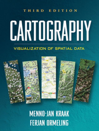
Cartography
 Inglés
 220 b
220 b
Política de devolución de 30 días
Clientes que también han comprado


Integrating cutting-edge technology with traditional cartographic principles, this text provides a framework for effectively visualizing and analyzing geospatial data. It gives students critical concepts and methods for harnessing the enormous amount of geospatial data that is available on the Internet and creating maps that can support real-world decision making. The third edition incorporates current developments in scientific and information visualization, multimedia, animation, virtual reality, and exploratory data analysis. The writing style is straightforward, clear, and accessible. Illustrated throughout with highly instructive diagrams and sample maps, the book includes 58 color plates.


Sobre el libro
Inglés

Regale este libro hoy
Es fácil
1 Añadir al carrito y elegir Entregar como regalo en el checkout 2 Le enviaremos un vale 3 El libro llegará a la dirección del destinatarioTambién puede interesarle


¡Hola! Soy Libroamiko, tu asesor de libros.
¿Cómo puedo ayudarte?