 Contacto
 Cómo comprar
Entrega
Guía de compras
Mapping India
 Inglés
 340 b
340 b
Política de devolución de 30 días
Clientes que también han comprado


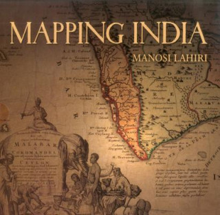
It began five hundred years ago when the very first modern maps of India were drafted. Travellers, wanderers, explorers and traders came overland from the West and carried back tales about the India of their perception. The first maps of India were drawn based on the accounts of these men. When the sea route to India opened, sailors ferried back information about the ports they touched on their way to India. Marine charts of the routes along the ocean coasts and artistic representations of port cities followed. As Europeans came in large numbers to trade and conquer, new territories further inland were mapped. The British surveyed and mapped India under their rule to settle borders, calculate tributes, assess taxes and record defence positions. At the end of the colonial period, once again maps identified the boundary between the new nations of India and Pakistan on maps of the sub-continent. "Mapping India" presents an overview of important maps that eloquently reflect the changing social and political fortunes of India. These maps speak of the commercial interests and wars that led to the colonisation of India, and show territories the size of countries that were conquered, ceded or controlled through treaties. They also record changed courses of rivers, routes taken by armies, people living in communities in new cities, places where famines occurred, how the highest peak was discovered and named, when native royalty gathered to pay respect to the British Emperor, and the destination to which Mahatma Gandhi marched with his supporters for the salt satyagraha. From the earliest chronicles of India to its post-Independence strides, "Mapping India" is the story of India recounted through its maps.


Sobre el libro
Inglés

Regale este libro hoy
Es fácil
1 Añadir al carrito y elegir Entregar como regalo en el checkout 2 Le enviaremos un vale 3 El libro llegará a la dirección del destinatarioTambién puede interesarle


 /
/
 Tapa blanda
 17.29
€
/
Tapa blanda
42.49
€
17.29
€
/
Tapa blanda
42.49
€
 /
Tapa blanda
27.89
€
/
Tapa blanda
27.89
€

¡Hola! Soy Libroamiko, tu asesor de libros.
¿Cómo puedo ayudarte?