
 Contacto
 Cómo comprar
Entrega
Guía de compras
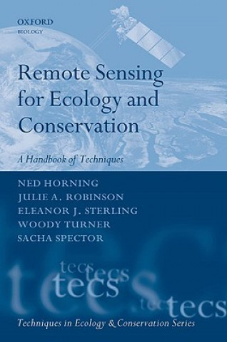
Remote Sensing for Ecology and Conservation
 Inglés
 291 b
291 b
Hasta 30 días para devoluciones
Clientes que también han comprado








 /
/
 Tapa blanda
 41.49
€
41.49
€


 /
Tapa blanda
17.89
€
/
Tapa blanda
17.89
€





 /
Tapa blanda
27.69
€
/
Tapa blanda
27.69
€
 /
Tapa blanda
28.19
€
/
Tapa blanda
28.19
€

The work of conservation biology has grown from local studies of single species into a discipline concerned with mapping and managing biodiversity on a global scale. Remote sensing, using satellite and aerial imaging to measure and map the environment, increasingly provides a vital tool for effective collection of the information needed to research and set policy for conservation priorities. The perceived complexities of remotely sensed data and analyses have tended to discourage scientists and managers from using this valuable resource. This text focuses on making remote sensing tools accessible to a larger audience of non-specialists, highlighting strengths and limitations while emphasizing the ways that remotely sensed data can be captured and used, especially for evaluating human impacts on ecological systems.


Sobre el libro
Inglés
Categorías

Regale este libro hoy
Es fácil
1 Añadir al carrito y elegir Entregar como regalo en el checkout 2 Le enviaremos un vale 3 El libro llegará a la dirección del destinatarioTambién puede interesarle


 /
Tapa blanda
302.09
€
/
Tapa blanda
302.09
€
 /
Tapa blanda
19.09
€
/
Tapa blanda
19.09
€














 /
Tapa blanda
49.19
€
/
Tapa blanda
49.19
€
¡Hola! Soy Libroamiko, tu asesor de libros.
¿Cómo puedo ayudarte?